Sunday, May 31, 2020

Nov-20-2019: Neuse River Trail Populaire 101

standard start / finish
[The plan was that we, McDave and I, would the route today from the standard start location, 
And we would do the route the next day starting from the southern / turn-around location. 
That being allowed since the "start any timed control" protocol was implemented.]

Do I have access to a RWGPS map of this course?
Probably, but at this moment, I don't feel like going looking for it.

All photos are courtesy of McDave.
"Group" selfie by McDave at the Noon start.
It seemed quite interesting at the time.  Can't recall for-sure, but I think this was the aftermath of clearing some storm damage.

"Group" selfie by McDave at the turn-around.  This is also the mid-way intermediate control on the NRT-200 perm-pop, and is the location where the "committee" discussed and decided upon the NC 2018 "Rando of the Year" and "Comeback of the Year" and "Volunteer of the Year" -- respectively McDave, MikeD, NCBob (aka, BikerBob).  [I note those awards here because I mentioned that to McDave while we were there.]

Don't know for whom this message was intended, but it was near the end of our ride.  [The timestamp on the photo shows that this was 41-minutes before the finish-photo.]

"Group" selfie by McDave.  Dave had "complained" that I had not smiled for either of the previous pics, so I made an effort for this one.  [I do NOT have a disappearing upper lip when I smile -- if I try to show my teeth, the result it atrocious at best.]
Permanent Route Name / #Distance Date Finishers DNF
NC: Neuse River Populaire / 3094 101 2019/11/20 2 0
Cert# RUSA# Name Club / ACP Code Time
RUSA-T94214 10234 McD_, David R North Carolina Bicycle Club / 933045 04:41
RUSA-T94215 6218 S__, Martin Randonneurs USA / 933095 04:41

This was my first time doing this route.
It made my November P-ride.
At this time, I don't feel like figuring out the consecutive P-count.
  
McDave did it MANY times last year as part of his pursuit of K-Hound and P-60.
His pursuit of K-Hound was actually pursuit of 10234-RUSA-kms.
And because of the demise of the Perms program combined with vacation travel,
Dave let his P-60 pursuit go after getting to P-59.
Instead, Dave made sure to get his R-60 on December 2nd, and
To snag 10234-exact kms.

[As noted above, the plan was for me to join Dave the next day,
Doing the route "reversed," starting 0700 or 0800.
But Dave also needed to get done in time to be at a meeting with his son and a college recruiter.
Further, although the route, with its many bridges, most every one requiring two 90-degree turns,
One to get onto the bridge and a second to get off the bridge,
Fit Dave's style and abilities,
Those repeated turns were like repeated stops and restarts for me.
They wore me out.
Or maybe it was the repeated accelerations to re-catch McDave?

Regardless, if I rode the next day with Dave,
I would slow him down and interfere with him getting easily to his meeting.

So, with over-tired legs from what should have been an easy ride, and
Not wanting to interfere with Dave's meeting the next day,
I begged off riding with Dave the next day.

As a result, this was my last ride of a Permanent route before the demise of traditional program.
Sad.] 


Friday, May 29, 2020

Nov-02-2019: Hicksboro 205 (reversed)

I originally designed the "Road to Hicksboro" to be ridden clockwise.
But added counter-clockwise so that we could finish NOT into the winter setting sun.
[Note: for the above link, I tried to access the RUSA website for the route description, 
But that function is either being blocked or all the Perm route descriptions have been deleted.] 

Understand that I think of the route clockwise.
I can see the route, even as I sit here, clockwise.
Well, more like I see the turns in my mind's eye in the clockwise direction.
I have ridden the course solo counter-clockwise, but
I have to concentrate very hard to see the turns counter-clockwise.

So, here is a "funny" -- the only one I recall as I type this on May-29-2020:
I was leading when we got to the 42.5-mile point, and
I hadn't brought a cue sheet with me, 'cuz who needs cue sheets?
But I was not 100% sure whether to turn or not.
So I asked the guys with GPS devices and the RWGPS map loaded thereon,
"Do we turn left here?"

In my defense, the house and grounds on that turn used to be beautiful,
But probably about six or seven years ago, the residents "moved on,"
And the new owners have not been able to keep the place to the previous standard
 ( google-street-view of the house )

Who made up the cast of characters this day?
  • BobB #5843 -- his 6th completed circuit of the "Road to Hicksboro", 
  • Ricochet Robert #6628, his 10th successful "Road to Hicksboro", 
  • Wilmington Rick #6985,  his 3rd "Hicksboro", and his first 200 (+) km ride anywhere since he broke his leg while training for the 2019 PBP.  Similar to his first 100 (+) km rando ride after recovering from the broken leg, I noticed no diminished ability. 
  • McDave #10234, his first "Road to Hicksboro", and
  • me #6218 -- my 14th completed "Hicksboro" circuit.  
Early on, I was trying to keep up, or at least close to the others on the many climbs.
However, maybe before reaching the 50-mile point,
I realized that in doing so, I was wearing myself out prematurely.
(More like I was already mostly worn out !)
So, I backed off on the climbs, and instead began spinning my way up the climbs.

Finally, a bit after leaving the penultimate control at Underwood Grocery,
My legs had recovered sufficiently that I could resume putting some effort into climbing.
And that allowed me to better keep up with the others.
Or perhaps they backed off their efforts somewhat?

I have no photos on the day.
I am unaware of photos by others on this day.

And since I have no real recollections of the ride beyond the limited bits shared above,
I close this post with an extract from the RUSA ride results function:

Permanent Route Name / #Distance Date Finishers DNF
NC: Road to Hicksboro / 1938 205 2019/11/02 5 0
Cert# RUSA# Name Club / ACP Code Time
RUSA-T93734 5843 B__, Bob Randonneurs USA / 933095 10:20
RUSA-T93735 6218 S__, Martin Randonneurs USA / 933095 10:20
RUSA-T93736 6628 B__, Robert D Randonneurs USA / 933095 10:20
RUSA-T93737 6985 R__, Richard A Randonneurs USA / 933095 10:20
RUSA-T93738 10234 MC_, David R North Carolina Bicycle Club / 933045 10:20
[I obviously chose this ride submission to show a small rebellion against the 
"must be in alphabetic order" guideline. 

I'm not the only one that occasionally shows that small amount of rebellion. 
There is a well-known local randonneur that sometimes does something similar to the above.
And I know there is well-known randonneuse in Maryland that sometimes does not follow the 
"must be in alphabetic order" protocol.]


I might not have bothered to blog this ride, except
This was the last "Road to Hicksboro" before the demise of the historic Perms Program.

 
One last set of information / statistics:
The first "Road to Hicksboro" was done on Apr-13-2013,
When Ricochet and I opened the account.

In those six-and-a-half years:
  • 19 different riders, 
  • in 21 different start groups, 
  • successfully completed the route 58 times. 
  • There were no DNF's. 
  •  
  • The average elapsed time to complete the route was  10h24, 
  • The minimum elapsed time was   9h00, 
  • The maximum elapsed time was  11h58.  

Thursday, May 28, 2020

Oct-19-2019: Triple-L 205

Let me be up front and absolutely clear on this:
As I type this on May-28-2020, 
I recall absolutely nothing about this ride.

My Excel log indicates that NCBob and started at 0700.
Or at least that was the official start time.
It is possible that we were a few minutes late starting -- I dunno'.

Since I recall nothing from the ride,
The only thing I'll do is post the photos taken and sent to be EPP.

Bob at the first intermediate control -- the gas station / convenience store / burgeoning diner on Red Mill Rd next to I-85.  Timestamp of photo is 0824 -- meaning it took almost an hour-and-a-half to cover the first approx 20-miles.  [photo credit to me]

Second intermediate control.  The gas station / convenience store next to US-501.  Timestamp on photo is 1024 -- meaning two hours between stopping at Red Mill Rd and stopping here.  [photo credit to me]

"Artistic" photo of one of my water bottles atop one of the gas pumps at Leasburg Grocery -- the turn-around control.  If'n U look carefully, U can see a partially hidden Bob in the background.  Timestamped 1214 -- meaning we had covered the approx 24-miles from the Timberlake control in one hour and fifty minutes, stopping time to stopping time.  [photo credit to me] 

A better proof that we got to the turn-around control -- Leasburg Grocery.  Timestamped 1215.  [photo credit to me] 

Timberlake control (next to US-501) on the return.  Timestamped 1413 -- meaning one minute under two hours, stopping time to stopping time, from Leasburg to Timberlake.  I imagine that Bob and I took our time in Leasburg to eat, drink, and rest -- so I imagine we may have had a bit of tailwind on the segment from Leasburg to Timberlake -- but I'm not going to check any weather almanac to confirm that.  [photo credit to me] 

Bikes leaning against the Red Mill control on the return.  Timestamped 1613 -- meaning 2 hours, 3 minutes from Timberlake to here (stopping time to stopping time).  I imagine that we may have taken a few extra minutes at Timberlake, sitting on the bench outside the store.  [photo credit to me] 

Pic of Bob at the finish.  If one is familiar with the finish location, one can assure oneself that this is at the finish location.  If not familiar, you might think it was just a non-descript parking lot.  Timestamped 1801 -- meaning one hour, 45 minutes from the Red Mill control (stopping time to stopping time).  I imagine that I forced Bob to join me in sitting inside the Red Mill control for 15 or so minutes before we undertook the final approx 20-miles.  [photo credit to me] 

I don't know for sure, but I suppose that Bob took the initial EPP photo at the start.
I don't currently have access to said likely photo.
Meh.

Official results:
Permanent Route Name / #DistanceDateFinishersDNF
NC: Leesville-Leasburg-Leesville (L-L-L) / 8312052019/10/1920
Cert#RUSA#NameClub / ACP CodeTime
RUSA-T936205843B__, BobRandonneurs USA / 93309510:58
RUSA-T936216218S__, MartinRandonneurs USA / 93309510:58

I might not have bothered to put up this blog post, but
I had the photos, and
This was the last time either of us rode the Triple-L route before the demise of the Perms program.
[However, as I type this, a revised Perms program is likely to arise soon
From the ashes of the original Perms program. 
Phoenix-like rebirth?]

This was the 19th time I did the Triple-L route for RUSA credit.
I also did the route once "for the fun of it", I guess.
And the first two times I tried this course, I DNF'd.  (June-2010 and July-2010)

This was the 11th time that Bob did the Triple-L route.
I'm pretty sure he never DNF'd on this course,
Nor did he ever ride it "for the fun of it".

 
There was one more successful ride of the Triple-L route before the aforementioned demise.
Our friend Richochet Robert completed the course, solo, on Dec-01-2019.
That, dear readers, was his 95th successful completion of Triple-L.
[Pure insanity!]


Triple-L [or properly, "Leesville-Leasburg-Leesville"] was a popular route:
The first official ride was March 13, 2010.
The last official ride (to-date) was December 01, 2019.
There were 302 completed rides in 159 start groups by 34 different riders.
The average elapsed time for all completed rides was:  10h29.
The fastest elapsed time was:   7h44.
The longest elapsed time was:  13h25.


Thanks to Byron, who completed the route "only" 63 times,
For creating, owning, and managing the route.
  

Wednesday, May 27, 2020

Oct-06-2019: "The Devil's Den" perm-pop #2608

Frederick, MD to Gettysburg Battlefield and back

This was my favorite ride of 2019.
The first time I had gone beyond North Carolina to do a RUSA sanctioned ride.
260-mile drive from my abode to the start; and a 260-mile drive afterward.

Several years ago, Crista had invited me to come up and ride a 4-state Perm, or
Ride a 3-state Perm-Pop with her and Chuck and whomever else joined in.
I was finally in a time and space to do so.

We discussed options.
After some back and forth, we settled on Sunday, October 6th and
We would do Crista's "The Devil's Den" perm-pop.
[RWGPS map-link:  click here.] 

Chuck would join us on the ride -- that was a given.
Crista would also advertise for other riders.
JoelD and DavidR joined the excursion.
[And Crista mentioned that maybe MishaH would also join the crew, and 
If Misha did join us, Crista noted, "it would be a hard day." 
I told Crista that I knew who Misha was, and yes, 
Trying to keep up with Misha would be hard, and 
Something I would not even try to do.]

I had ridden the "Bahama Beach" #1404 perm-pop on Saturday, the day before.
But I had done some decent riding the latter half of September,
Had ridden the Bahama route the day before with an easy effort, and
Was definitely looking forward to an enjoyable day,
But maybe one that would stress me out at least a little.

To get to Frederick, MD (the start location) for the 8 am start,
I got up at 2 am on Sunday morning, looking to leave my place by 2:30.

I was a little slow, and didn't get underway until 2:35.
And subsequently had to stop to make sure the right-side rear door was securely closed.

Zooming through the night, I stopped somewhere in Virgina (well south of Petersburg)
To re-fill the gas tank and empty my bladder.

I stopped in Maryland, just before Frederick, to grab some breakfast.
And arrived, with only a little confusion in the last mile or so,
At the start some minutes before 8 am (I don't recall how many minutes).

I was somewhat concerned because I didn't see any obvious rando vehicles or people.
Thinking back, I think Chuck and Crista were parked about 20 yards from where I parked.
But the were not at their vehicle, so I was a little concerned that I might not be in the correct place.
Obviously, it turned out that I was at the correct location.
[Crista later indicated that we started several minutes after 8 am, and 
That I was the one that was not ready to start on time. 
I guess Crista was accurate in that comment, but I don't know so.]

Before the start, Crista warned me about two sharp but short inclines
That we would encounter in the early going.

I was riding along, in a warming up easy gear / cadence,
Probably chatting without noticing what the road was doing when we got to the first.
Suddenly, I had to stand up and muscle the bike up the slope.
I was clearly in the wrong gear and frame of mind, but
I forced my way up the incline at about 2.5 or 3 mph -- it was tough.

I caught back up to the others, and resumed the easy, warming up approach to pedaling.
I am quite certain I was again chatting to someone and did not notice the second one
Until I was on the slope, DEFINTELY in the wrong gear!
I started to try to muscle up that second sharp (but short) incline.
No soap -- I hopped off and walked up to the crest.
And again caught back up.

That was the last of unexpected slopes catching me off-guard.

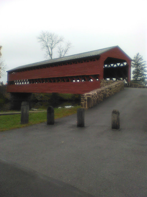
We were still in Maryland when we crossed the first covered bridge on the day.
Chuck and Crista after we had crossed the covered bridge.  My first EVER covered bridge, btw.  I should have taken some panoranmic pics from this location since there was a nice looking farmstead across the road from where Chuck and Crista were standing.  [photo credit to me]

We were soon back underway and crossed into Pennsylvania.
This seems a logical point at which to mention that Maryland and Pennsylvania
Made the 3rd and 4th different states that I've ridden in, RUSA-credit-wise.
[The first two being North Carolina (of course) and Virginia (on the Kerr Lake Loop Perm).]

We, or at least I was expecting much sunnier and warmer conditions than we got on the day.
Somewhere still south of the Mason-Dixon line, we received our first drizzle / sprinkle / rain on the day.
It would drizzle / sprinkle / light-rain on us for most of the day.
And sometimes perhaps the adjective "light" should be removed from the rain description.

As we approached the Gettysburg Battlefield, we rode past the Eisenhower Farm.
I had looked for and found the Farm on the RWGPS map that Crista had sent me.
But during the ride, I forgot to even look around to see what the area looked like.

Suddenly, we were at the second covered bridge on the ride.
I walked into bridge before attempting another photo.
Chuck, Crista, and Dave (?) possibly waiting for Joel before crossing the bridge and riding on to the Battlefield.  This is essentially a replica of the bridge that Confederate troops used both before and after the battle, and Union troops also used the bridge after the battle.  [photo credit to me]
Looking back at the bridge after walking across.  There is an historical marker just to right of this scene, but I could not get a decent pic of the text -- maybe next time.  [photo by me -- but it appear that I should have cropped this photo to remove so much of that asphalt in the foreground -- oh, well] 
Suddenly, we were in the Battlefield Park.
Thank goodness Chuck, Crista, David, and Joel knew where they were going.
I did not have to do any navigating!

The "Devil's Den" is in the midst of the Battlefield.
Due to the rainy conditions, I took almost no photos.
In fact, after lunching in Gettysburg town and returning to the Battlefield,
I chose to take none of the suggested photos because it was just so rainy and dreary and
The photos would not have been very interesting.

However, what follows are the photos that I did take, and the one that Crista took and sent to me.
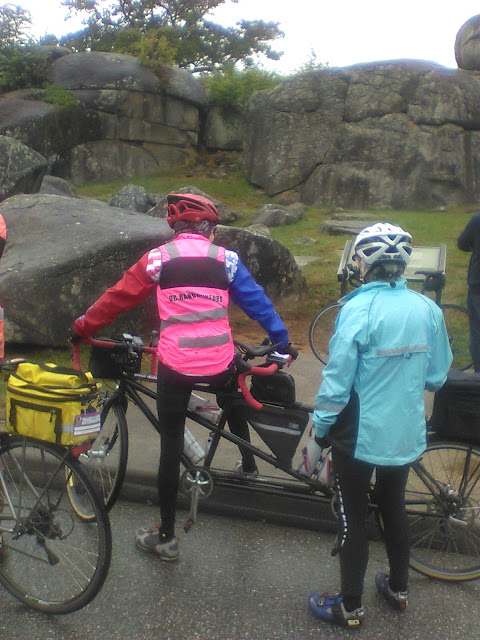
Chuck and Crista in front of the historical marker in front of the some of the boulders in the Devil's Den.  [photo credit to me]
More boulders.  [my photo]
Devil's Den plaque.  Not centered -- I could barely see the viewer.  And I should have turned the phone sideways to get a better pic.  Maybe next time.  [my photo]
One of the monuments in the midst of the Devil's Den.  [my photo]
Me, atop Culp's Hill, in front of the tower from which one likely would get an excellent view of the entire Battlefield -- on a clear day.  Crista suggested that I might want to climb the tower, but I looked at the sky and concluded the view would likely be very obscured, and decided to put off climbing that tower until a later date, hopefully a sunnier later date.  [photo by Crista(?) or Chuck(?)] 

After the above, we rode into town for lunch.
Then got back on our steeds in the drizzle / sprinkle / rain.

One moment of humor:
At some point on the return, with what I recall was a heavy sprinkle,
Crista suddenly blurted out, "why am I getting wet?"
Chuck immediately commented, "see what I've been telling you; she's oblivious."
[Well, that isn't an exact quote, but it represents the sentiment AND 
Is consistent with the light teasing that Crista had been receiving regarding 
Being protected behind Chuck on the tandem.]

I did attempt one moment of mostly-humor during the ride.
I don't recall if it was when outbound or when returning to Frederick.
At some point, it seemed that Chuck and Crista were picking up the pace.
I recall I was struggling just a bit, and said,
"Hey, just because I rode with that really fast tandem a couple weeks ago,
Doesn't mean that you should pick up the pace today."

I'm not sure how that comment was greeted.

We finished the ride in fine style.
Permanent Route Name / #DistanceDateFinishersDNF
MD: The Devil's Den / 26081312019/10/0650
Cert#RUSA#NameClub / ACP CodeTime
RUSA-T93127338B___, CristaDC Randonneurs / 94601207:27
RUSA-T93128385W___, CharlesDC Randonneurs / 94601207:27
RUSA-T931296218S___, MartinRandonneurs USA / 93309507:27
RUSA-T931303678D___, JoelDC Randonneurs / 94601207:32
RUSA-T931319432R___, David JDC Randonneurs / 94601207:27

 
Instead of putting my bike on the rack on the rear of my car,
I decided to take the wheels off my steed and put the frame into the back seat area
To keep the bike from getting soaked on the ride home.

Crista and I were discussing my going up that way again in 2020 to ride.
Probably to ride to Gettysburg on a sunny day,
Maybe to ride over toward Camp David.
We had tentatively agreed that June would be a good month.
Or was it May?

It didn't matter, because COVID-19 threw a major spanner into the works.

Although I skipped things I thought to include, and
Maybe I included things that would have been better off no included,
The above is my story, and I will be sticking to it. 

RUSA + COVID - June Events, Permanents and Insurance

Sent:  Friday, May 15, 2020 6:28 AM
To:  RUSA RBAs ...
Subject:  June Events, Permanents and Insurance

Brevets and other events

Our hold on sanctioning events will extend at least through the end of June. 

Most states are still experiencing community spread.  Testing and tracing are not up to the standards promulgated by our national health organizations.  Social distancing is still encouraged nationwide.  While we can come up with ways to help keep our riders safe, running events can have an impact on communities whether that's through virus transmission or the risk of accidents.  As a result, our Pandemic Response Committee has recommended that we extend the hold through the end of June. 

The RUSA board has voted and accepted that recommendation.

From our website:  Randonneuring is long-distance unsupported endurance cycling. This style of riding is non-competitive in nature, and self-sufficiency is paramount. When riders participate in randonneuring events, they are part of a long tradition that goes back to the beginning of the sport of cycling in France and Italy. Friendly camaraderie, not competition, is the hallmark of randonneuring.

As a riding community, we have shared goals and awards recognizing our achievements.  It's the camaraderie that makes us a club.  When we open, it should be nationwide.  That doesn't mean that every RBA will be forced to run events but they should have the ability to do so, working with their local riders.  Opening now, on a geographical piecemeal basis, with a heavy emphasis on solo riding, would be abandoning much of what makes up our sport.

Permanents and insurance

We have some good news to share!  Effective May 1, we have a new insurance program that includes permanents.  However, it's not a simple matter of flipping a switch.  We have work ahead of us - Deb Banks, John Lee Ellis and Crista Borras are working as a committee on the details of the revised program.  We have major system changes to make and organizational work to do.  Crista, John Lee and Deb will be reaching out to existing route owners to get the organizational work underway in parallel with our web team work.

A restart of permanents will be incorporated into the recommendations from our pandemic response committee.

More details on insurance and any required changes will be shared before we reopen any RUSA riding.  Stay tuned !

July and forward

By mid June at the latest, we expect to provide an update for July.  The pandemic committee has also started to think about the guidance and support that we might provide to RBAs as we build our reopen plan. 

Dave Thompson, for the RUSA Board.