Friday, March 22, 2024

Jul-18-2021: non-rando "Denny's Store Sortie"

Cuz I always said / wrote / typed that the Denny's Store route was my favorite perm-pop. 
And to at least pretend that I was checking out the route for possible re-activation. 
And also, I knew that I would soon want to check out possible Mayo Lake routes, 
And that makes sense since 
The Mayo Lake route is simply the Denny's Store routes with a loop up to Mayo Lake. 
 
Following a pattern of reporting what is in my Excel ride log: 
  • essentially "Denny's Store Sortie" (but starting / finishing at my sleep quarters), 
  • 0504 start    --    overcast, some sprinkles, 
  • 93.4-miles in 6:24 in-motion meaning 14.6-mph avg in-motion (elapsed time unknown). 
 
Photos on the day: 
Statue of Vietnam era soldier at Butner Gazebo Park.  Timestamp 0636 -- so an hour-and-a-half after starting.  
 
Banner advertising the Granville County 275th Anniversary celebration.  The aforementioned statue in the background.  Timestamp also 0636. 
  
Turtle before "rescue" timestamped 0812.  Given the timestamp on the next photo, taken at the Allensville Store, I have to think that this turtle was warming itself on Old Allensville Rd approx one mile south of the Allensville corner.  [I "have" to rescue the turtles encountered, else my friend LML might skutch me out.] 
 
Timestamp 0824.  Allensville Store.  More of Lynn's "peeps" than ever seen before or since.  The 2nd or 3rd "peep" from the left edge did actually ask me about "that woman that used to ride up here with you."  If one were look through all the "Denny's Store" posts, I'm confident that other photos taken of men sitting on those benches would reveal which of the two it was that inquired.  In response to the inquiry, I gave a pretty good descriptive answer regarding Lynn.  Proof that if a cyclist will take the time to chat with locals, even locals that are quite over-sized, cyclists can make friends among the locals that will pass on positive messages about cyclists to the other "good ole boys" (regardless of ethnic background). 
 
Iconic photo location on the Denny's Store rides.  This is just about the perfect angle / background for Denny's Store photos.  Too bad it was mostly overcast.  Timestamp 0852. 
 
 
And that completes this photo-journalist post / story.  
And to make use of the oft used or modified tag line:  "I reckon I'll be sticking to the story." 
    

Jul-16-2021: non-rando R-B-R

 R-B-R not re-activated, but I wanted to do the route as it is easy, yet serves as a training ride, and also is a decent way for me to measure my progress toward getting into shape or staying in shape. 
 
As noted in my Excel ride log: 
  • R-B-R test ride, start Strickland-6Forks, finish Honeycutt, 
  • 0452 start, 1003 finish,  5h11 elapsed 
  • 67.8-miles, 4:44 in-motion, meaning an avg 14.3-mph in-motion.  
 
A few photos: 
Although I snapped this photo on the return, it makes more sense to include in the outbound flow because one needs to use this pedestrian crosswalk when turning onto NC-56 when one is about to leave Creedmoor, but inbound that relatively new "road furniture" put in place because of the changes in how the roads intersect does not come into play. 
 

Sign to advertise the 275th anniversary of Granville County hanging from one of the buildings at the main "downtown" corner in Stem.  Yes; Granville County was established in 1746 when North Carolina was still a Crown Colony.  Timestamp 0642. 
 

When R-B-R was an active perm-pop, and before COVID, this was the preferred lunch stop on the "Denny's Store Sortie" 138k perm-pop, though the cue sheet and brevet/control cards indicated that the c-store "kitty corner" from this store was the control indicated as the "open control" in Berea.  On this ride, I noticed that this store, which had better lunch options, had not survived the COVID lockdowns.  Timestamp 0730 -- 2 hours, 38 minutes after starting the ride from my sleep quarters.  
 
Shoofly.  I often stop here to take a photo, but esp. if the day is hot and humid.  Timestamp 0759 -- i.e., 29 minutes after the above Berea photo.  It usually takes me 20-25 minutes in-motion from Berea to here.  I could gander a guess as to the dynamics of stopping in Berea and riding from Berea to Shoofly, but I just don't recall if I took the Berea photo on arrival or just before leaving; therefore, I'll not hazard any comments about the ride dynamics between Berea and Shoofly,  [I wonder how many more times I could refer to Berea and/or Shoofly before completing this photo caption.] 

  
Photos published, with significant captions, will be my story to which I will be sticking for this ride. 
 

Jul-10-2021: Pseudo R-B-R

My Excel log indicates that I did the following "route": 
  • to BayLeaf CVS, to PUE, then the R-B-R route, stopping at LowesFoods, and back to my HQ; 
  • 0538 start, 5h23 elapsed -- stops in Berea, Creedmoor, LowesFoods 
  • good for:  70.0-miles, with 4:53 in-motion, which gives 14.3-mph avg in-motion 
 
I don't know why I rode from my place to the Bay Leaf CVS. 
Was I expecting to meet someone there at 0600? 
 
I don't know why I then made note of stopping at PUE. 
Was I still looking to meet someone there just after 0600 (instead of at the CVS)? 
 
There is absolutely no hint of riding with another person on this day. 
 
Another question would be:  why didn't I do this ride on Jul-09, my birthday? 
Oh, I suddenly recall why I did this ride on Saturday instead of Friday-the-9th. 
At my part-time job at Lowes Foods, I filled in for a full-timer who was covering for another full-timer who was on vacation that week.  
 
Regardless, based on the notes in my Excel log, 
I left my abode at 0538, and would have left PUE at approx 0610 
To ride the core of the R-B-R route, arriving back at my hovel at 1101. 
Must have been a good ride. 
 
Having almost no knowledge of this ride, 
One might wonder why I bother to blog about it nearly 3 years later. 
Answer:  I have two photos I can publish: 
The timestamp on this turtle photo is 0735 -- which is 36-minutes before the timestamp of the following photo, which shows the front of the c-store in Berea.  36-minutes before Berea suggests that this turtle photo was taken on Brogden Rd just before reaching Stem.  [photo credit to me] 

I'm not sure that making this photo appear as "extra large" helps any, and might make things blurrier than they need be.  Anyway, this is the front of the Berea c-store, with the saddle of my trusty steed visible below the window.  Timestamp is 0811.  Based on previous estimates above, that would suggest that I rode the approx 28-miles from PUE to Berea in 2h01 (and that would include stops for some stop-signs and a couple stop-lights).  I'm thinking there may have been a southerly wind helping the pace to Berea; but that would then suggest a bit of a headwind coming back toward Raleigh.  A southwesterly wind makes sense for Jul-10 as around here, in the midst of summer, regardless the forecast, when the temperature climbs into the 80's and 90's, the wind invariably backs around to come from the southwest.  [photo credit to me] 
 
Not much of a story, but I will stick to it (as doing so allows me to publish those two photos (and then delete them from my laptop or other storage devices / locations)). 
  

Thursday, March 21, 2024

Jul-01-2021: NRT check-out ride

There was information that the Neuse River Greenway Trail was blocked, again. 
 
The first time the NRT was blocked was due to a significant bridge being replaced. 
My friend BobB and I had to deal with that on Nov-03-2018
However, upon reviewing that blog post, there is not even a single word about that closure. 
 
To check out the situation on the NRT, I decided to ride from the Falls Dam to the reported closure. 
This is what I found: 


As I type this on March 20, 2024, there are two more blockages on the NRT. 
Stages #1 and #2 on some sewer construction project(s). 
 
There was a reasonable detour to get around the Stage #1 closure, and 
Many people, including some randonneurs used that detour for the NRT-perm-pop. 
 
However, once Stage #2 was implemented, 
There was / is no reasonable and safe detour for cyclists. 
The sewer construction project(s) is(are) not scheduled for completion until Dec-30-2024. 
As a result, at least two perm-pops and a 200-km perm have been de-activated. 
  

Jun-26-2021: Good-bye Hereford Rd

Typing this nearly three years after the fact, the only thing(s) I actually recall is visiting the site on Hereford Rd with the photos below.  And, now, nearly three years later, it appears that a decision has been made to essentially abandon Hereford Rd; that is, it appears that no effort will be made to repair the damage. 


As for the "path" - i.e., the route - that I rode to get to Hereford Rd that day, well, I don't recall any of the ride except for the decision as I climbed away from Falls Lake on Cheek Rd to detour onto Hereford and see what there was to see. 
 
However, this is what I recorded in my Excel ride log: 
  • joined the TLC group to Grissom + Creedmoor to FallsLake counter-clock to a friend's 
    • [that route seems a bit strange, but as I type this, I think I could re-create the route] 
  • 0800 start, 1334 at friend's, i.e.,  5h34 elapsed 
  • 64.5-miles, 4:43 in-motion, 13.7-mph avg pace while in motion 
Another boring / strange story, but I will be sticking with it. 
After all, the point was/is just to show WHY Hereford Rd was closed and remains closed. 
   

Jun-18-2021: "IvaHawk Special #1"

When Covid hit, IvaHawk went exploring (via motor vehicle) looking for roads with low-low traffic and the opportunity to avoid potential contagious interactions.  He "discovered" a series of "new roads" perfect for cycling.  ["perfect" meaning low traffic, up-and-down, back-and-forth, with some possibly interesting scenery or historic places or otherwise notable sites] 
 
Those that know the two of us best, that would be the "Irregulars," know that when Irregulars rides were sorta' regular Saturday events, Iva had at least one time indicated that although he grew up in North Carolina, I was leading the group onto roads and to places that he had never previously seen.  With the "IvaHawk Specials," Iva turned the tables and led me to roads and places I had never been. 
 
The main point of "Iva Special #1" was to introduce me to Rassie Crabtree Rd -- a road I had ridden past many times while doing the rando "Leesville - Leasburg - Leesville" Perm and other mostly non-rando rides.  My conclusion regarding Rassie Crabtree:  I love it!  [As for why, I invite you to join Iva or me some day or go ride it yourself.]  
 
The east end of Rassie Crabtree T's into Bowen Rd, which I had also never ridden AND which fits the up-and-down, back-and-forth criteria. 
 
When we got to the north end of Bowen (where it crosses Helena Moriah Rd and becomes Stoney Mtn Rd), I talked Iva into continuing onto Stoney Mtn even though he had intended to turn onto Helena Moriah.  Iva indicated that he thought Stoney Mtn was rather non-descript and perhaps boring, maybe even more-or-less flat.  In actuality, although not necessarily impressive, the climb up to the main elevation on Stoney Mtn does get up to at least a 5.6% incline, which is not something that either Iva or I would scoff at. 
 
I include this rather plain "story" because it is the first of the "IvaHawk Specials" that have become a staple of our non-rando rides.  And, for any rando that might read this, as a result of those "Iva Specials," all of which start and end at Gazebo Park in Butner, I hope to develop a brevet-pop or two that start and end at the Gazebo Park. 
 
My stats: 
  • 23.6-m commute in 1:40 to Butner, 
  • 43.6-m for the main ride in 3:19 w/ Iva, then 
  • we had lunch at "El Rio" in Butner (or at least I recall we did). 


Jun-05-2021: virtual "Bay Leaf - Oxford - Bay Leaf" perm-pop

BobB, IvaHawk, and I essentially did the ole "Oxford" 104-km perm-pop, except that the route had not been re-submitted / reactivated, and on the return, we diverged from what was the official route to include Philo White and Flat Rock roads.  Doing that added approx 1.8-miles and (according to RWGPS) 197 ft of climbing. 
 
I insisted on taking a photo at the Oxford BP station (turn-around). 
Bob on the left in a PacTour Route-66 jersey (that originally belonged to Richard Lawrence, RIP) and IvaHawk on the right in I-don't-recall-the-what/why of his jersey. 
 
 
I usually accuse of Bob of trying to intimidate me whenever he wears any of his PacTour kit.  He stifles a chuckle whenever I do that. 
 
My ride stats on the day: 
  • 5.7-mile commute in 24-minutes to the gathering at PUE. 
  • 66.5-miles in 4:47 in-motion for the "Oxford with Flat Rock: route.  
 
That's the story for this ride, which I only blogged in order to publish that photo. 
 

May 15, 2021: Morrisville - Siler City 300k Brevet

Short rando season for us as concerns regarding COVID-19 remained high, esp. among elderly and/or immune compromised individuals. 
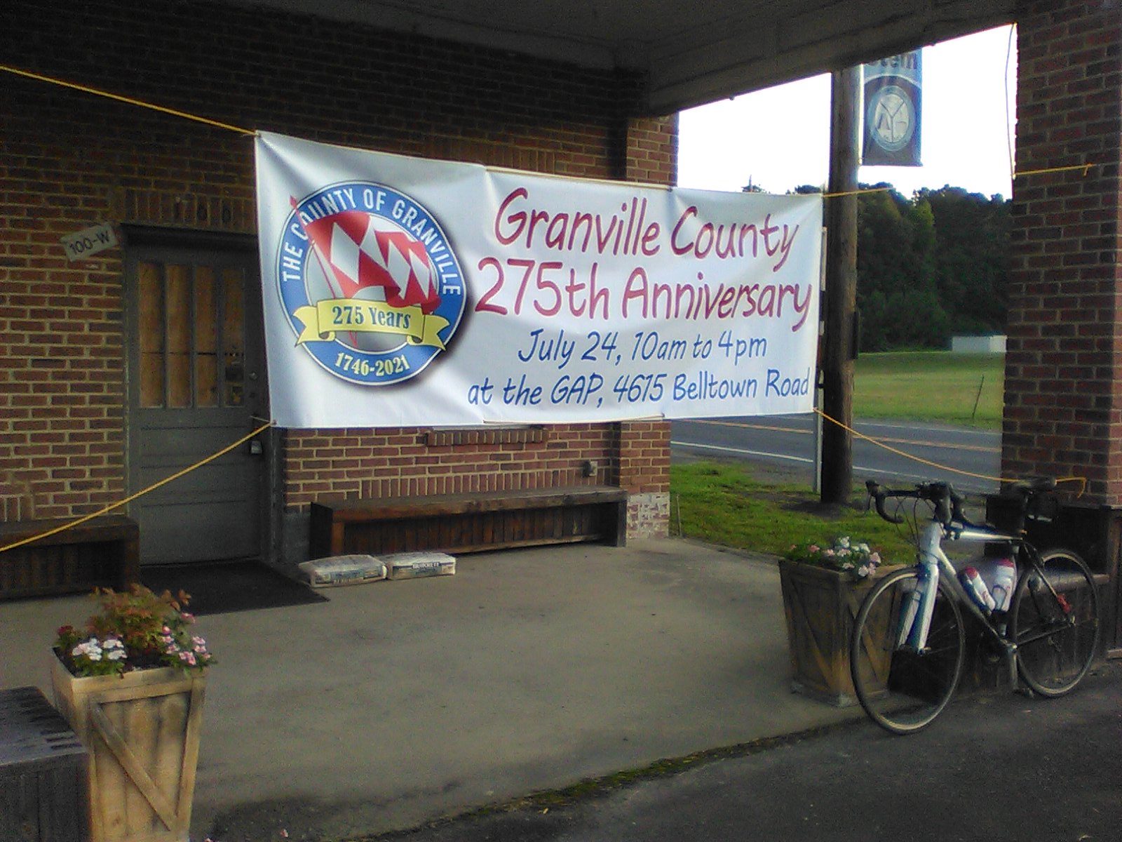
RBA Alan viewed through the looking glass at rider check-in / route start.  Well, okay, viewed above/beyond the handlebars and helmet of my steed.  [timestamp 0622; I actually got started about three minutes later, meaning I started at least 10-minutes after my plan of 0615 -- didn't really matter since my official start time would be the timestamp of the photo (or at least that is what I recall)] 

 
Although it has taken almost 3 years for me to post something about this 300k brevet, I much enjoyed my completely solo adventure. 
 
Due to limits that enterprises were still employing, combined with some concern on my part about lingering or renewed COVID variations, I had prepared some food to carry with me to eat en route -- actual food such as some boneless, skinless chicken thighs. 
 
I ate the first half-thigh at the Andrew's Store (original location at the intersection of Andrew's Store Rd and US-15/501.  While that was only 20-miles into the brevet, it marked the ~ 40-mile mark for me since I had cycle commuted ~ 20-miles to the start.  While nibbling on that half-thigh, and possibly removing some clothing, a rider-not-to-be-identified rode swiftly past the store.  I doubt that rider saw me.  [Later, when we should have crossed outbound vs inbound, I again did not see that rider.  Seemed rather strange at the time; still seems rather strange.] 
 
I stopped some 16 or 20 miles later at a side-road off of Castle Rock Farm Rd to consume the second half of the above referenced chicken thigh and definitely removed long-sleeve and knee-warmer kit. 
 
The timestamp on the photo indicates that I got to the first intermediate control at Snow Camp, approx 50-miles from the start of the 300, at 1044 -- indicating ~ 4h20 to cover that ~ 50-miles -- I judge that quite reasonable given the two extra stops before getting to Snow Camp (I have traditionally only paused at stop-lights and stop-signs between the start and Snow Camp outbound).  I'm sure I ate another half-thigh and acquired some cold beverage to replace that which I had consumed to that point. 

 
I apparently was "feeling good" between Snow Camp and the "100k control" in Siler City as, according to the timestamp on the Siler City photo, I arrived there exactly one hour after previously arriving at Snow Camp.  I ate another half-thigh (or maybe an entire thigh) at Siler City before shoving off for Seagrove. 

 
I stopped in the shade somewhere along Old Coleridge Rd to consume another half-chicken-thigh.  Or maybe, by the time I completed the impromptu stop, I had consumed all three chicken thighs I had with me.  My recollection is that the three fast-dudes indicated below in the ride results overtook me shortly after I had resumed pedaling after the impromptu stop on Old Coleridge. 
 
I calmly continued my ride, but perhaps I was slowing a bit, as the timestamp on the photo at the Seagrove control is 1425.  Well, the difference in time between the Siler City and Seagrove controls suggests that I covered that 50-kms in approx two-and-a-half hour in-motion:  I cannot complain about that.  As I approached Seagrove, I decided that I was going to order a large chocolate shake at the control -- I did do that although I was surprised at the price -- as I type this, I think I recall that I actually ate the last of the chicken thighs while at/in Seagrove. 

  
I took my time to eat/drink the chocolate shake and to eat ... whatever.  I also decided to call RBA Alan to let him know where I was and to clue him in that the fast-dudes were well on their way back toward Morrisville.  [And now that I type that sentence, I wonder if what I typed earlier about where/when the fast dudes overtook me is correct.  Oh, well.] 
 
Alan indicated that Chet had returned to his place shortly after starting to report a DNF due to a drive-system failure on his bike only approx 6-miles ito the route.  Alan asked it I had seen Cyndy VdW -- nope.  I suggested that perhaps Cyndy was also DNF because the failure would likely have been on their tandem.  Alan was convinced that Cyndy was not DNF and was therefore somewhere on the course.  I agreed to keep an eye out for her on my return voyage to Siler City. 

I'm pretty sure I spent at least 30-minutes at the Seagrove control, and probably closer to 45-minutes (because I recall thinking that I was spending a lot more time there than I ever had (on the 300)). 
 
No memory or recollection of the return journey to Siler City except that I did not see Cyndy.  I called Alan to let him know that I had not seen her, and therefore I figured that she and Chet had DNF'd together on their tandem.  However, Alan again indicated that Chet had only referred to himself as DNF'ing and he was still adamant that Cyndy was somewhere on the course.  
Siler City control on the return.  Timestamp 1733 -- only 3h08 after the timestamp on the Seagrove control photo.  Conclusion:  either I didn't spend as much time in Seagrove as I now think, or I rode relatively quickly (for me) on that 50-kms, or perhaps there was a nice tailwind that pushed me along (except that RUSA #12 explains that there is no such thing as a tailwind in cycling). 
 
I reached Snow Camp on the return at 1838 (according to the timestamp on the photo).  1h05 after arriving at Siler City.  I was perhaps slowing down or maybe the phone chat with Alan (and maybe others ??) took some time before I lsft Siler City. 

 
No recollections or current thoughts about the 50-miles from Snow Camp to the finish.  I arrived at the finish at 2333 (according to the timestamp on the photo taken at the finish control). 
 
I rested sitting on RBA Alan's front steps, and then made the ~ 20-mile cycle commute up NC-54, along Hillsboro St past part of the NC State community, skirted Cameron Village, walked up the steep part of Lassiter Mill Rd (I'd rather walk up that at 2.1-mph than risk falling over at 3-mph), skirted North Hills shopping center, and soft-pedaled the rest of my way to my hovel. 
 
The above is my extremely boring story for the 2021 Morrisville 300k brevet, but I will be sticking with the above. 
 
My results on the day: 
  • 20.4-mile commute to the start, with 1:30 in-motion, i.e., an 13.5-mph pedal. 
  • 187.8-miles for the brevet route, with 14:30 in-motion, i.e., 12.9-mph avg. 
  • 19.7-mile commute back to north Raleigh, 1:47 in-motion, i.e., 11.0-mph avg. 
 
Official RUSA results: 
RegionClubTypeDistanceDateFinishersDNF
NC: RaleighNorth Carolina Bicycle Club / 933045ACPB3002021/05/1552

Cert#RUSA#NameClub / ACP CodeTimeMedal
2664816176H__, Ian PageAsheville International Randonneurs / 93301112:37 
2664823095J__, WesRandonneurs USA / 93309512:30 
266483####not to be ID'dxxxxx12:30 
2664846218S__, MartinNorth Carolina Bicycle Club / 93304517:11 
26648564T__, MarkSeattle International Randonneurs / 94701812:37